miller jeep trail
 02-22-2010, 09:42 AM
#11
JK Freak
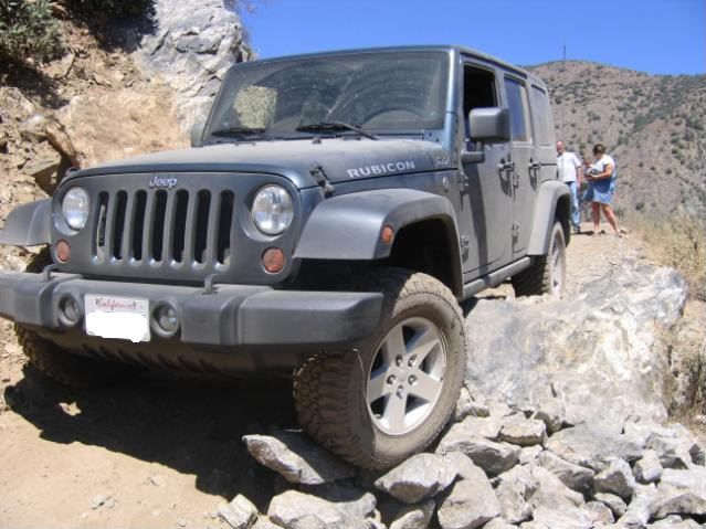
Miller is one of the best trails i can think of lots of tight switchbacks that are challenging then the last 3 miles is all rock the whole trail is ascending, when you reach the top you have a 15mile descent on fireroad ending at hungry valley OHV
you can see more here and type in miller in the search box man have i missed this trail this year.
you can see more here and type in miller in the search box man have i missed this trail this year.
 02-22-2010, 09:56 AM
#12
JK-Forum Founder

Join Date: Jul 2006
Location: Laguna Niguel, CA
Posts: 36,534
Likes: 0
Received 16 Likes
on
15 Posts
Miller is one of the best trails i can think of lots of tight switchbacks that are challenging then the last 3 miles is all rock the whole trail is ascending, when you reach the top you have a 15mile descent on fireroad ending at hungry valley OHV
you can see more here and type in miller in the search box man have i missed this trail this year.
you can see more here and type in miller in the search box man have i missed this trail this year.
 02-22-2010, 12:53 PM
#13
JK Freak
Most of the ash (from the Day Fire) is now gone and the area is starting to see some growth. With this winters storms we should have good growth come spring time. All of the trails in the area are closed due to snow conditions. Local trails start to reopen arround the end of May.
Their is also an open logging contract for Miller Jeep trail and alamo mountain for the removal of hazard trees (burned from the fire) that has yet to be completed. The contract kept the trail closed last year. We'll have to see what happens this spring.
Their is also an open logging contract for Miller Jeep trail and alamo mountain for the removal of hazard trees (burned from the fire) that has yet to be completed. The contract kept the trail closed last year. We'll have to see what happens this spring.
 02-23-2010, 06:37 PM
#15
Copy Lat & Long to Google Earth to find location.
Lat Long
34.73535948, -119.03881823, Lockwood/Miller Jeep Trail,Difficult
34.72183297, -119.05612390, Lockwood/Miller Jeep Trail,
34.70608135, -119.03278828, Lockwood/Miller Jeep Trail,
34.69991621, -119.00043027, Lockwood/Miller Jeep Trail,
34.67605161, -118.97859087, Lockwood/Miller Jeep Trail,
34.67627398, -118.97781572, Lockwood/Miller Jeep Trail,
34.73121880, -118.87328763, Lockwood/Miller Jeep Trail,
33
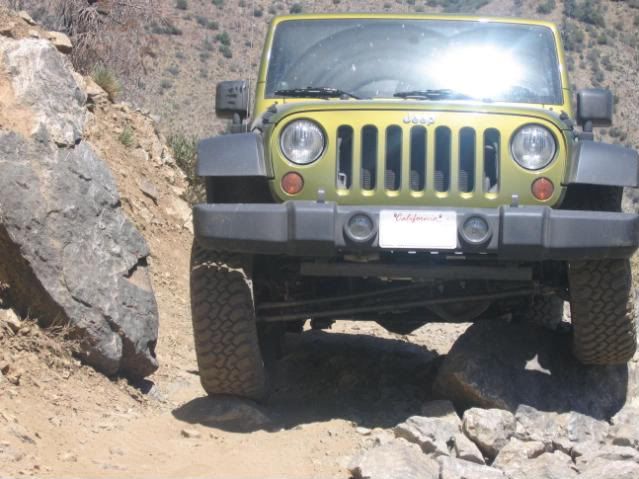
 BTW "The squeeze" is gone!
Lat Long
34.73535948, -119.03881823, Lockwood/Miller Jeep Trail,Difficult
34.72183297, -119.05612390, Lockwood/Miller Jeep Trail,
34.70608135, -119.03278828, Lockwood/Miller Jeep Trail,
34.69991621, -119.00043027, Lockwood/Miller Jeep Trail,
34.67605161, -118.97859087, Lockwood/Miller Jeep Trail,
34.67627398, -118.97781572, Lockwood/Miller Jeep Trail,
34.73121880, -118.87328763, Lockwood/Miller Jeep Trail,
33